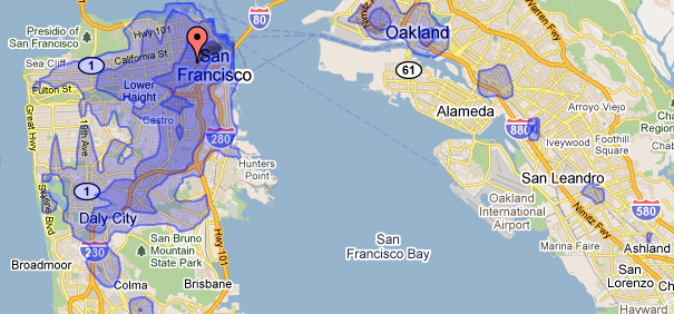
WalkScore Transit Time
From the folks who brought you the infamous Walk Score for your neighborhood comes the Transit Time Map. This clever tool lets you calculate where you can travel on transit from any location, within certain amounts of time (15, 30, and 45 minutes). It’s not something you want to use while planning a trip, but rather it focuses on the mobility offered from where you are. This is a great way to see how easily you can access areas based on where you might want to live, and the effects of living a few minutes closer to better transit. Â It’s only available in a few select cities right now, but it’s an invaluable tool to figuring out how easy you can do things you care about: visit friends, get to work, go out, etc.

I think this is a great tool, thanks for sharing. I’m contemplating a move in Portland, and knowing how easily I’ll be able to get around is key. It represents freedom. I’ll take a WalkScore that’s slightly lower, if I can get to where my friends are faster!